Please visit my new site for recent tales from the trail, including adventures along the Pacific Crest Trail in Washington!
www.westcoasthikergirl.com
|
Please visit my new site for recent tales from the trail, including adventures along the Pacific Crest Trail in Washington! www.westcoasthikergirl.com
0 Comments
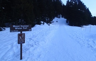
Yesterday was the first day of spring and the forecast was for sunshine! I decided to head for the North Shore mountains and do a trail that I try to do every winter: Mount Seymour summit in Mount Seymour Provincial Park.
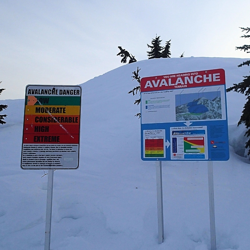
I had to be up early to take hubby to work so decided to head to the mountain for sunrise. Unfortunately the road up to Mount Seymour is closed at night through the winter months, reopening at 7 a.m. each morning. Traffic was really light getting through the city so I had a few minutes to wait before I could pass through the gates. The sun was rising just as I pulled into the upper parking lot at the ski resort, creating an awesome orange and pink glow in the eastern sky. No pictures could do it justice though! I decided to wear my trail crampons instead of my snowshoes. There had been fresh snow a few days earlier, but I figured the Sunday hikers would likely have compacted the trail enough for me to manage just fine. The first section of trail climbs steadily, tracking at the edge of the forest alongside a ski run. Eventually it splits from the ski run and has some ups and downs. In the summer that section of trail passes through areas of ponds and small streams. After about half an hour of climbing I got my first view of the summit, and of the nearby mountains.  First view west of the North Shore and Sea to Sky range. The sky continued to lighten, though it was a filtered light with a layer of high, thin clouds. I reached the next great viewpoint after another 15 minutes or so. This spot is adjacent to the top of the highest ski hill and offers great views east, south, and west. It's a good destination for those who want views but don't quite have the stamina to make it all the way to the summit. 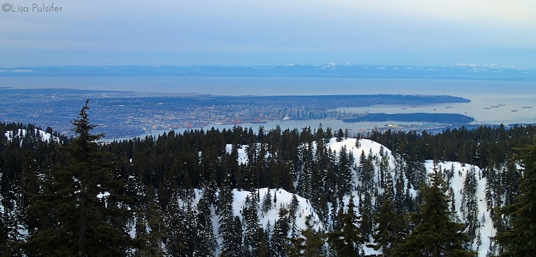 Looking down at Vancouver, with Vancouver Island in the distance. 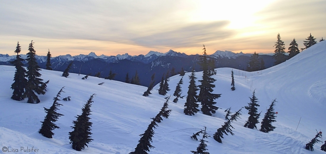 Filtered sunrise light over the eastern mountains. The next section of trail drops and climbs over a couple ridges. You also enter into the true backcountry area of the park, accompanied with large warning signs for avalanche risk. Thankfully today's risk was low and either way I wasn't planning on venturing off trail into avalanche-prone terrain.
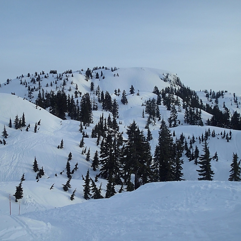
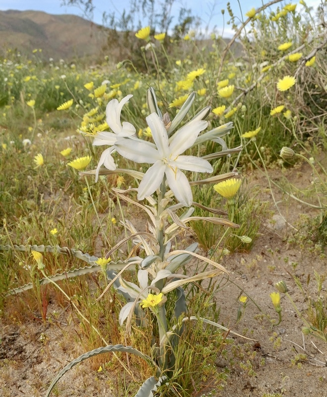
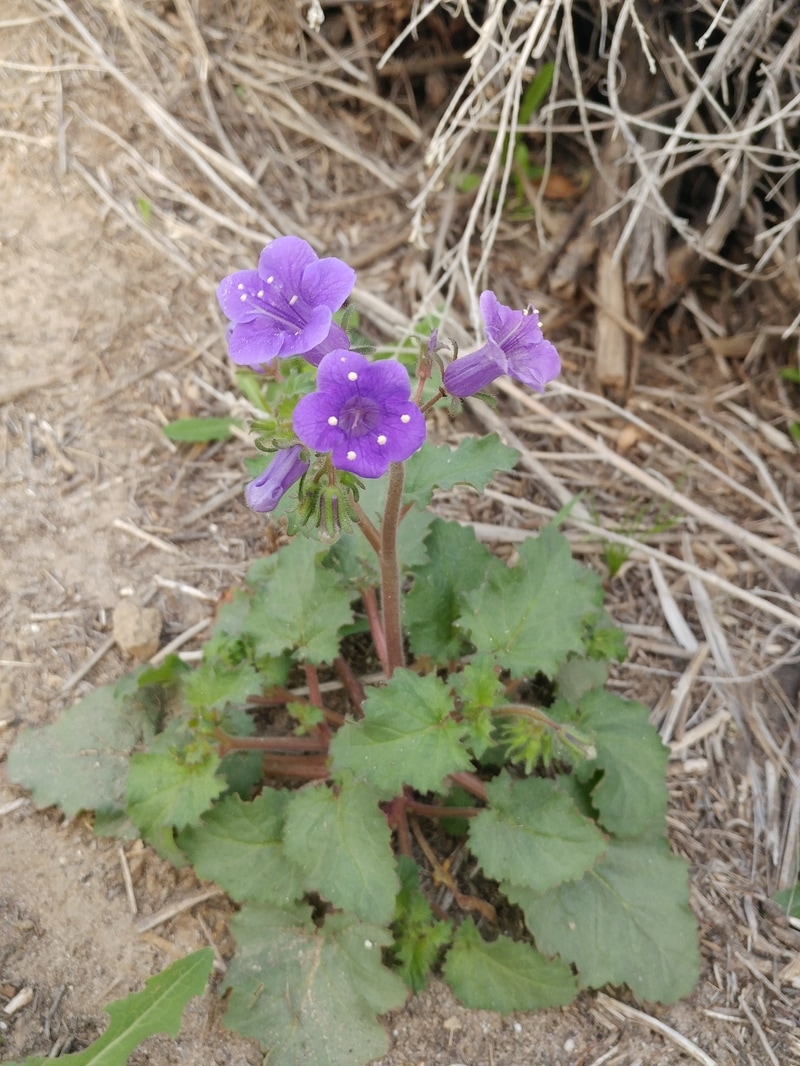
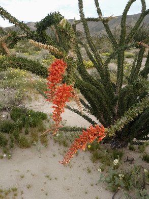
The last section of trail curves around to the northeast side of the First Peak. The trail climbs rather steeply into a bowl and then makes one last push to a ridge between peaks. It was incredibly windy up on the ridge, and even windier on top of First Peak! I snapped a couple quick pics and then dropped back down, continuing on towards Second Peak. 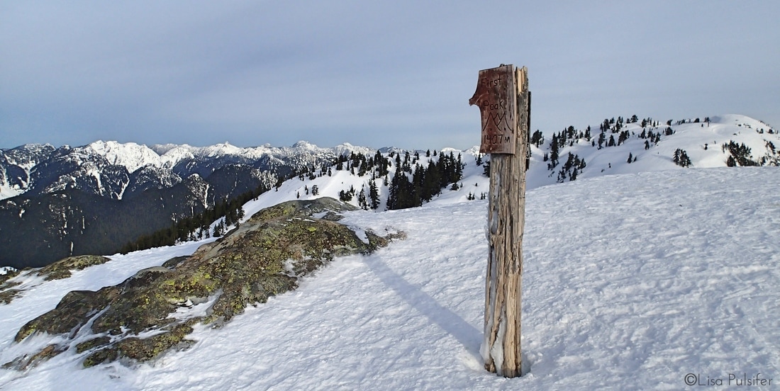 Summit post on First Peak. Second Peak is in the background to the right. The trail to Second Peak drops to a saddle and then climbs steeply a couple hundred feet to the summit. Fewer hikers make the winter trek to the second peak, so the boot path was a bit more rugged, but certainly doable, with a few extra breaks to catch my breath. It was possibly even windier on top of Second Peak, but the views to the north were worth my efforts. 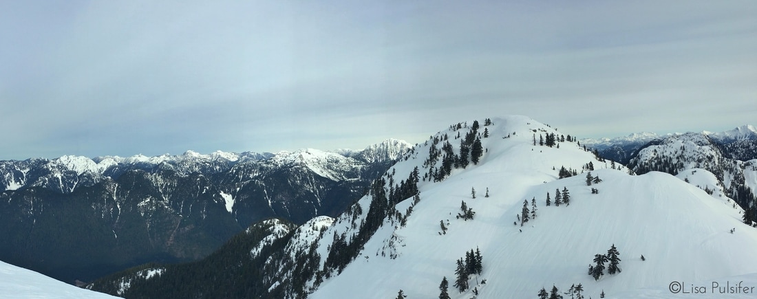 Third Peak (true summit) and the Sea to Sky mountain range beyond. I have never yet had the chance to make it to Third Peak, the true summit of Mount Seymour. Unfortunately it wasn't to be my day for it yet. There was absolutely no boot path, and some significant cornices to navigate to reach the saddle between the peaks. I'll just have to wait until the snow is gone and try for it again another day. Instead, I enjoyed a well-deserved break out of the wind on the western side of Second Peak. This vantage point offered up yet another great view of the city below. 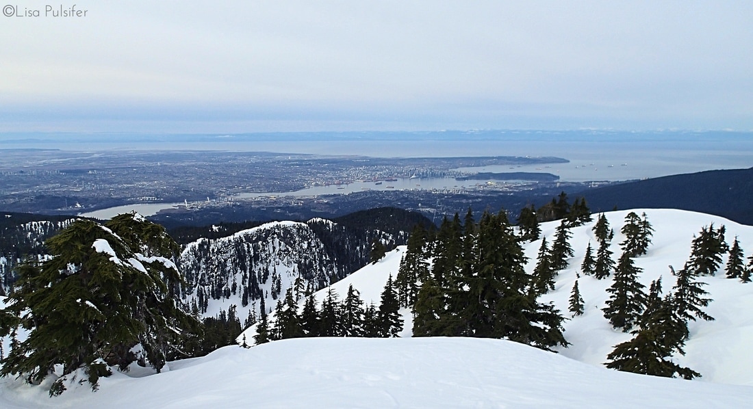 Looking down on Vancouver from near Second Peak. Up to this point I had only seen two other hikers and had enjoyed the summits to myself. Certainly an apt reward for getting up and on the trail early! As I made my way back down the trail I ran into more and more hikers heading up. If the forecast was to be believed, it was likely to be our last sunny day for a while. I made really good time on the way back, even enjoying a few short glissades on the steeper slopes. Instead of heading straight back to the car I decided to take a 1 km spur trail over to First Lake (they love numbers on this mountain...) 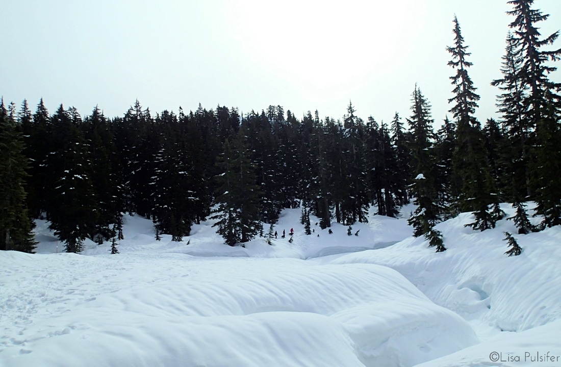 Snow-covered First Lake Last week I had the ridiculous good fortune of being able to take a trip to San Diego. The primary reason for the trip was to visit some very good friends of ours and get some much-needed vitamin D. Even though we live a full country's length away from our friends, we still find ways to meet up for adventures. They've travelled to the northwest to explore both Olympic and Rainier National Parks with us. They were also a huge support for us during our hike on the John Muir Trail last summer. If you've read through those posts, you may recall that our friend Joe surprised us on top of Mount Whitney for our last sunrise! 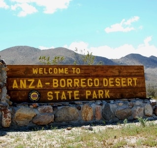 (Source: Flickr @mslaura) (Source: Flickr @mslaura) As soon as we booked our flights we started talking about what sort of hike we should do. My immediate thought was to explore into the desert, a completely foreign ecosystem to me. So we planned a day trip to Anza-Borrego State Park, about an hour and a half drive east of San Diego. As our trip got closer we realised that we might just be lucky enough to see the desert in bloom. About a week before our trip we started to see news reports about the possibility of a "super bloom" in the Anza-Borrego desert. We also started following the wildflower report for the area. In an effort to beat the heat, we decided to get up really, really early (4 a.m.) and make it to the desert for sunrise. We pulled into Borrego Springs with only a hint of light in the sky. Our destination was Coyote Canyon, about 5 miles down a dirt road. We parked partway along the dirt road near one of the stream crossings and at a trailhead for the Ocotillo Trail. Our timing was absolutely perfect; the sky was just starting to brighten. Sunrise in the desert is an incredible sight. A sunrise that reveals fields of amazing, colourful flowers is even more incredible! 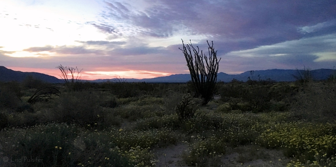 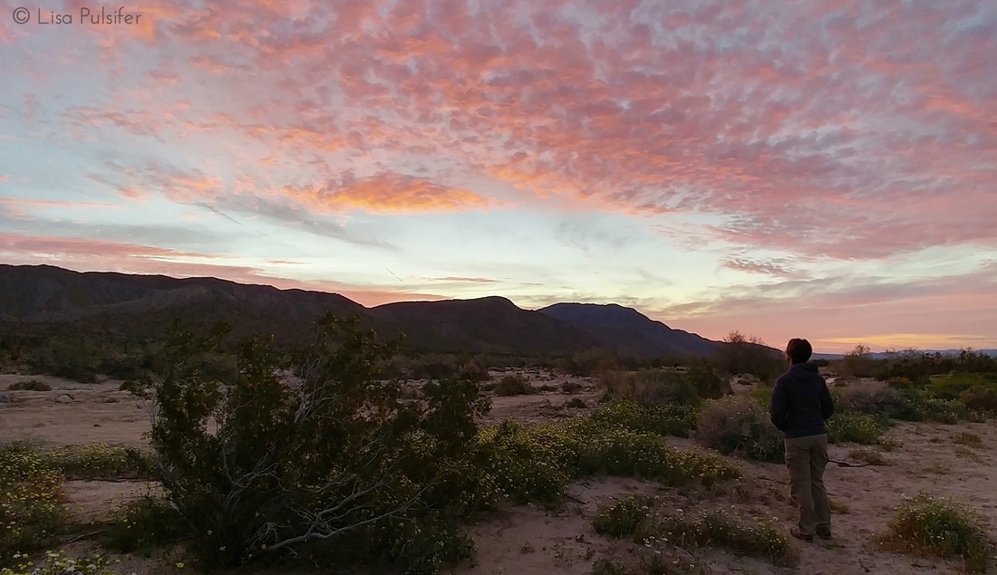 For our first couple miles of the day we wandered along the dirt road, taking in the amazing variety of wildflowers. Among many others, there were Desert Lupine and Desert Lilies, Asters, Canterbury Bells, Monkeyflowers and Paintbrush. As the sun rose higher, the brilliant flowers of the Ocotillo and the Beavertail Cactus started to open as well!
After about an hour of wandering, we headed off onto the Lower Willows trail. This trail travels through a lowland section of the Coyote Canyon that is fed by a spring. Apparently it is one area of the park that seldom dries out. As such it is surprisingly lush and humid, full of greenery and blossoms. We caught glimpses of Barrel Cactus on the nearby hillsides and could also see a Palm oasis partway along. 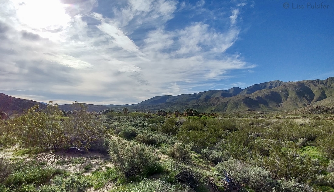 After a couple miles the trail reconnects with the Coyote Canyon road. We followed the road as it tracked back south, climbing through more arid desert landscape again. 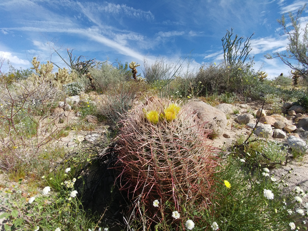 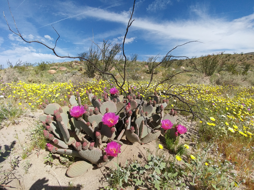 The views of wildflowers and the distant desert hills were fantastic.
We finished our loop with a brief ankle-deep wade through the creek, a refreshing and cool relief for our feet! Instead of heading back down the dirt road to our car we took the Ocotillo Trail, which meandered through the flats, following along the North bank of the creek and passing through many more wildflowers and beneath shade-bearing Ocotillos. We made it back to our car around 11, just as the real heat of the day started to set in. There were also many more visitors making their way down the Coyote Canyon road. I feel incredibly lucky to not only have seen the amazing desert bloom but also to have enjoyed my first desert sunrise. A little while back I shared a post about how to get out and hike more. One of my suggestions was to find a local hiking group. I have to admit though that I had not yet been out with a group. I felt more comfortable hiking with my usual partner (my husband) or a friend that I've pre-vetted for hiking. However my usual hiking partner's schedules have been getting busier which means it was time for me to reach out to a local group. A couple months ago I joined the Wanderung group, a Vancouver-based email callout system for hikers. When someone wants to head out on an adventure, they send an email callout to the mailing list. Wanderung also sends a weekly newsletter with lots of great details such as Leave No Trace tips, Avalanche awareness and recent trip reports. There are usually a handful of callouts each weekend, with groups ranging from about 4 to 10 people. So far most of the callouts have headed to the North Shore mountains, an area I'm pretty comfortable snowshoeing by myself. This week however a callout came through for a hike into Manning Park, a provincial park about 2 hours east of Vancouver. I had already been thinking about heading that way on my own, and decided it made much more sense (and more safe!) to take a carload. I replied to the email right away and offered up my chauffeur services. I was headed to Manning Park, and more specifically to Windy Joe Lookout! 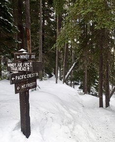 Hike Name: Windy Joe Date: Saturday February 25 Location: Manning Park, BC Approx. drive time: 2 hours Distance: 10 mi. / 15 km Elevation gain: 2000 ft / 600 m Max. elevation: 6050 ft / 1850 m Time on trail: 5.5 hours I met the 4 other hikers at a pre-arranged rendezvous spot in the city at 8 a.m. We loaded into the car and quickly got down to the business of getting to know each other. One of the hikers had even brought delicious matcha white chocolate cookies to warm us all up to him. The time passed quickly with everyone sharing hiking stories and getting to know one another. We made it to trailhead just after 10. It took a few minutes to get ourselves organized into our winter weather gear. Meanwhile a pair of large ravens watched the proceedings no doubt hoping we'd drop a treat or two. 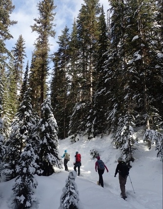 Heading up the road (Credit: @moveablefeast) Heading up the road (Credit: @moveablefeast) We hit the trail right around 10:30. The first couple kilometres were a very gentle and flat wander along the Similkameen River, which has it's source in Manning Park. We took a couple short breaks to admire the snow and ice formations and also to do a bit of unfortunate snowshoe repair (trail lesson: zipties are an essential quick repair item!) After two kilometres we reached a junction with an old forest service road. The Similkameen River trail continued to the left. We turned right, starting the slow climb upwards toward Windy Joe. The trail had a pretty moderate grade, seeing as we were following an old forest service road. It never really got steep enough to bother putting up the heel lifts on our snowshoes. The road took us through the forest, curving as it followed the flank of the mountain. We crossed a small stream flowing through a ravine and then started switchbacking properly up the mountain. 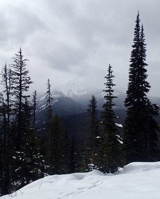 Frosty Mountain through the clouds Frosty Mountain through the clouds There were kilometre markings on the trees but they didn't seem entirely accurate. However, somewhere around the 4 km mark we started to get openings in the trees with decent views of the nearby peaks. Our first viewpoint offered us a look down into the valley at Manning Park Resort and Blackwall Peak beyond. Around the 5 km mark I started catching glimpses of a triangular peak to the south-west. We finally got a better look at it near the PCT junction and declared it to be Frosty Mountain, the highest and most prominent peak in the park. We continued our gradual climb along the road. I started to get a bit more excited as we passed the 7 km marker. The trailhead sign had indicated the lookout was at 7.3 km. Those markers had to be misplaced though, otherwise that was the longest 0.3 km I've ever hiked! I'm sure it didn't help that the wind had come up, the clouds had dropped and we were hungry for our lunches! 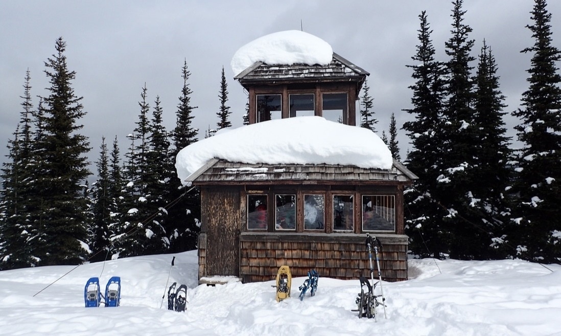 Sheltered in the lookout tower (Credit: @moveablefeast) We reached the ridiculously cute lookout shelter just after 1 p.m. While far from warm, it was still nice to be sheltered from the wind and flurries of the summit. We settled in and devoured our lunches, then enjoyed a bit of time to explore the shelter and the surrounding views (which were lessening every minute as the latest snowstorm rolled in.) 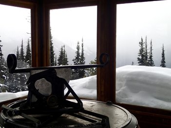 The shelter has a second story reached by a steep ladder and trap door. There were great interpretation signs featuring details about the lookout tower and pointing out the various peaks in view. There was also a wooden pedestal with a metal sighting device on it, which was used for determining the bearing of a forest fire. After enjoying a good 45 minute rest in the shelter it was time to turn around and wander our way back down the trail. It was a pretty quick trip back with fewer stops for breaks and an easy downward grade to follow. It seemed like we were wandering along the Similkameen River again in no time, and made it back to the trailhead about 2 hours after leaving the lookout. All in all it was an incredibly successful trip. The five of us were a very cohesive hiking group and certainly enjoyed each other's company and conversation. While the weather wasn't perfect, it was still good enough, treating us to some sunshine in the morning, an occasional view and even an enjoyable light snowfall on the hike down. The lookout tower itself is a great destination with interesting views of the park. I will certainly do this trail again! 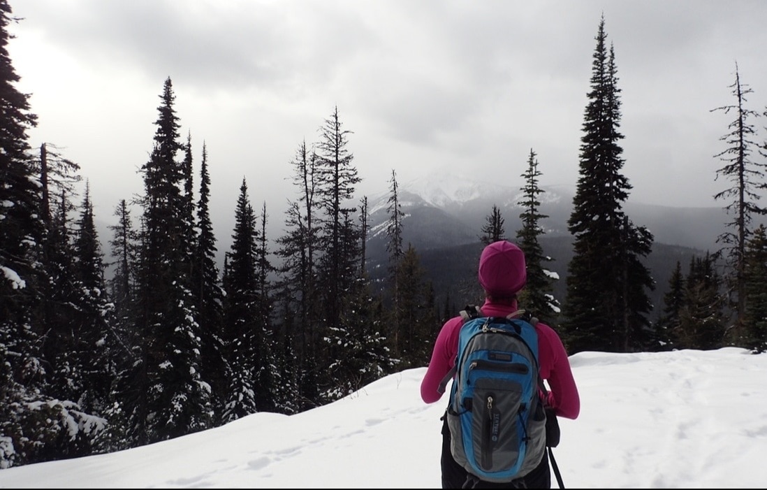 One last peek of Frosty Mountain (Credit: @moveablefeast) This past weekend was a long weekend in British Columbia known as "Family Day". This bonus holiday Monday in February is inspired by the idea of taking the time to participate in activities with your family, and so many local attractions offer great discounts. The weather was getting better and better, so I made plans with a hiking buddy to get together and head up a newer local attraction: the Sea to Sky Gondola. We would then have access to some great mountain snowshoeing.
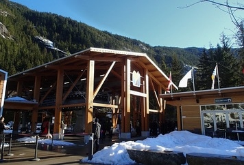
The Sea to Sky Gondola offers access to some amazing backcountry terrain below the very prominent Sky Pilot Mountain. Unfortunately I hadn't yet had the chance to ride the gondola up, having decided that $40 was a bit steep for a trip up a mountain. On previous visits I had taken the 10 km trail from the base to the summit of the gondola, and ridden the gondola down. Thankfully this weekend the gondola was offering a half-price ticket in honour of Family Day, which made it much more affordable. My friend and I hit the road early and made it to Squamish with plenty of time to relax and enjoy a coffee in a local café. We made it over to the gondola base just before 9:30 and joined the handful of other outdoor enthusiasts catching the first rides up, many with backcountry skis! After a quick and scenic ride up, we were standing at 3000 feet, and strapping on our snowshoes to climb higher.
The first section of trail follows a service road away from the Summit Lodge. After a few minutes we came to a junction with a large trail map and turned left. A few more minutes on a road, and then we were into the forest and on a proper trail. It was perfectly peaceful in the forest as we moseyed along. Before too long though the trail started to climb and we were treated to our first views of the nearby mountains. 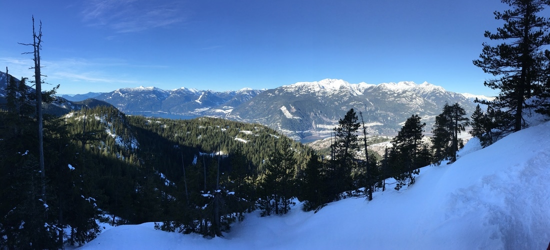 The trail continued to climb though a bit more gradually as we followed a low ridge to a great lookout spot. This was the end of the official winter tourist's snowshoe trail. We took a short snack break and enjoyed the view before gathering ourselves to press onwards, knowing that there was a track made by other hikers familiar with the trail.
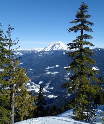
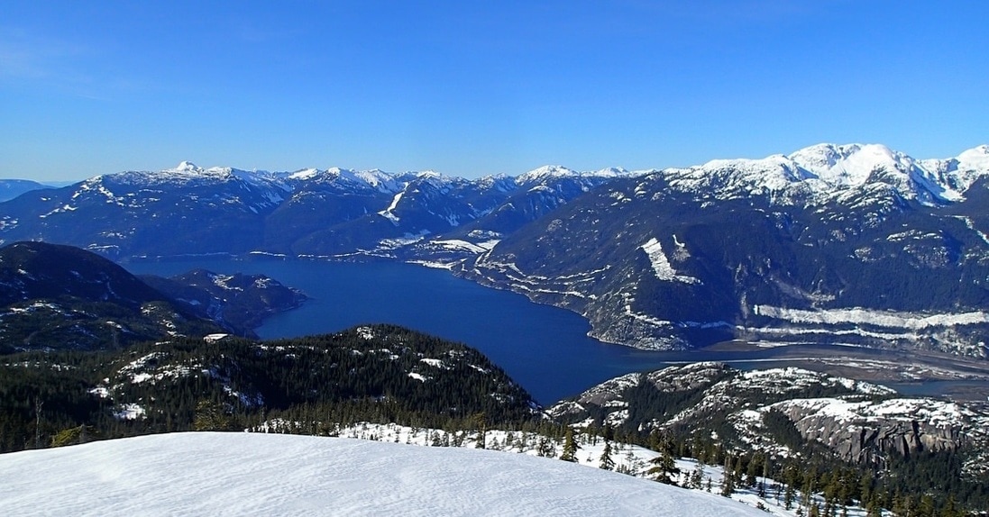 The view south to Howe Sound 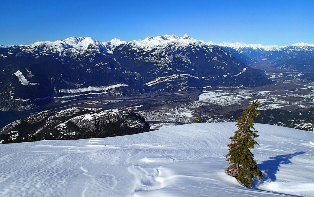 Looking down to the city of Squamish and the mountains beyond 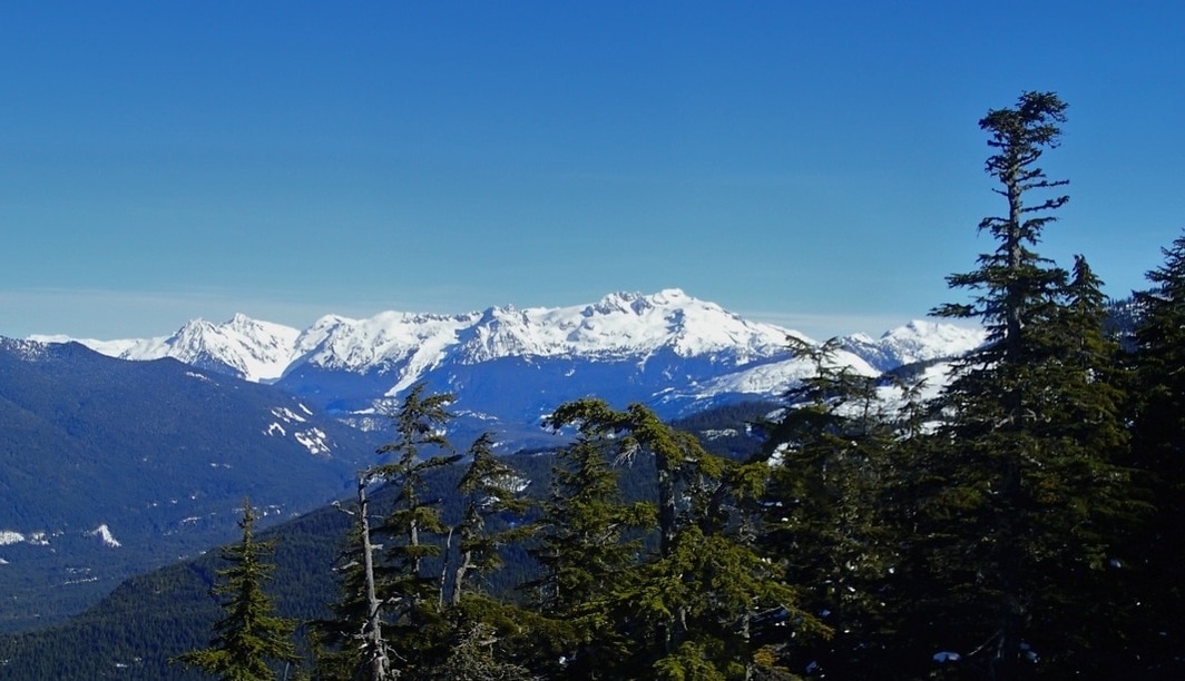 Looking east toward Diamond Head We enjoyed a long break at the overlook, soaking in the warm sunshine and the spring-like temperatures. The return trip passed incredibly quickly, with very little effort. It was amazing how many people were at the Summit Lodge, many marvelling at the snow as if it was their first time in it (it might have been for a few...) We took in the awesome view of Sky Pilot and then caught the gondola down, thrilled with our mountain-top adventures. 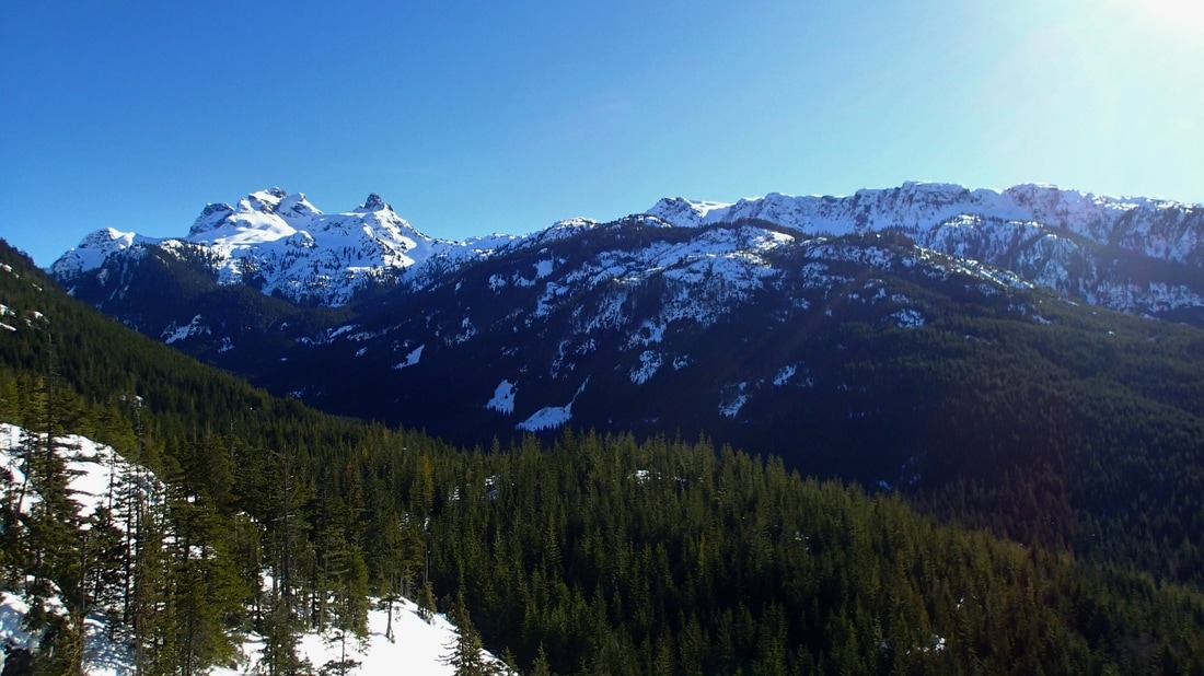 We're in the middle of the January doldrums here in the Pacific northwest. The Christmas season is over, the foot of snow we got in December has melted, and we're now being hit by a relentless series of rainstorms. I'm sure I'm not alone in dreaming about warm, sunny days on trail. Something I've been thinking about so far this January is how to get out and hike more. I thought I'd share some of my ideas and inspirations, knowing that there are others who have similar ambitions and yet challenges with the execution.  A hiking MeetUp group (Source: Dennis Jarvis on Flickr) Find a variety of partners or a hiking group Not all of us are lucky enough to have a partner who is as ambitious to hike regularly. Share your hiking tales with everyone you know and start building up a little black book of friends who express interest in joining you. There are also many hiking groups out there, often found through sites like MeetUp or Facebook (Girls Who Hike is a great Facebook community example!) REI can also help connect you with group hikes, as can many local trail organizations. A Google search of "hike community" or "trail association" may bring up some resources in your community. 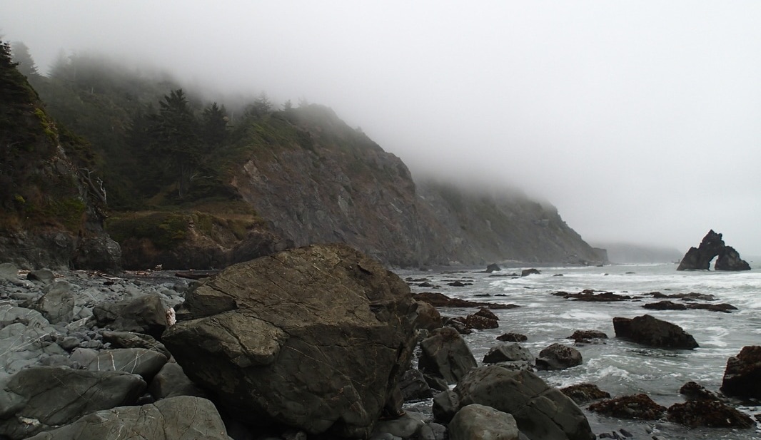 A foggy morning along the Northern California coastline. Gear up and go out in any weather Don't let a drizzly day keep you from getting out! Keep a list of cloudy and rainy day hikes. Think forest walks, valley wanders or seaside strolls. Even a familiar hike can feel completely different on a grey day. Just be sure to wear layers, have a good raincoat and of course to pack along the 10 Essentials. 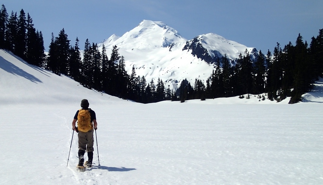 Challenge yourself to get out every week, no matter the conditions! Join a challenge to keep yourself going While hiking is certainly a very personal activity, there are some who have figured out ways to make it a bit more competitive. The 52 Hike Challenge is a great example of this! It's a global movement hoping to inspire and connect people to get out for a hike a week. Another great example I've seen is SoCal Hiker's Six-Pack of Peaks Challenge. I really love the idea of this and encourage you to develop your own Six-Pack of Peaks challenge in your local area! 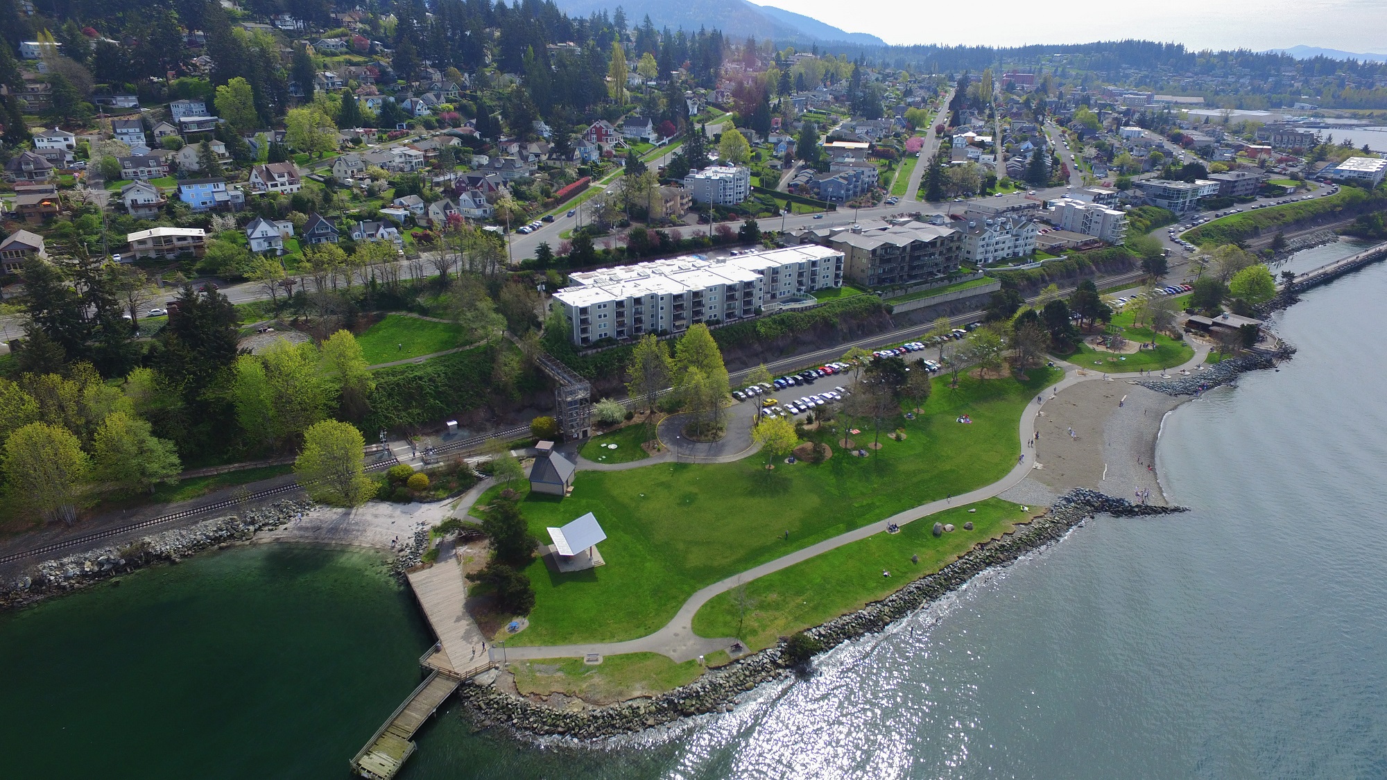 Boulevard Park in Bellingham, WA (Source: Sky Gremlin Productions) Urban hikes count too! Have a look around your neighbourhood. Are there any city or county parks nearby? Even 30 to 60 minutes wandering in an urban park can make you feel better. Once I really started paying attention, I realised that there are nearly a dozen parks with great walking trails within about a 20-minute drive. Pull up Google Maps and have a look, or check the Parks & Rec listings on your city and county websites.  ChatSelfie from this week's #ParkChat on Twitter Connect and get inspired Sometimes we just can't make it out to the trails. For those in-between times, find ways to connect with other hikers. For the past few months I've been participating semi-regularly in #ParkChat, a Twitter discussion every Wednesday evening about our National Parks. Or on Fridays you can join #HikerChat, the biggest outdoor chat on Twitter. If you're more visually inspired, then wander through some Instagram or Flickr hashtags, like #optoutside or #hike. Whatever your inspiration and however you manage, what matters is that you get outside. Challenge your mental self and get out on a rainy day, or opt for an urban solo wander through a nearby park. As REI has been telling us for the past year, #OptOutside and you'll feel better!
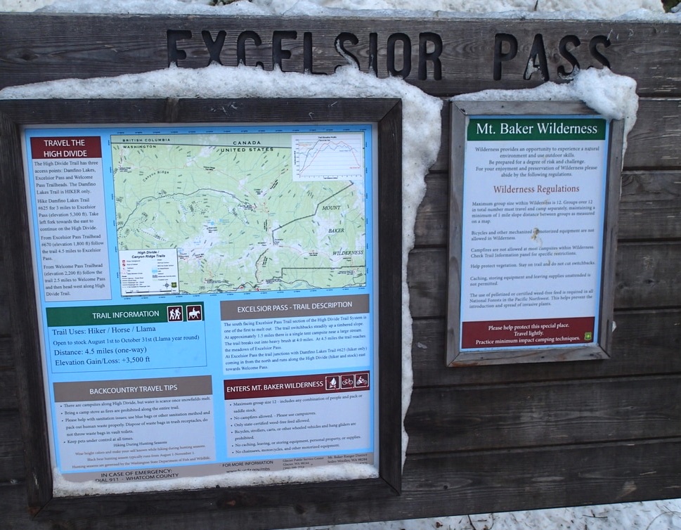
Please feel free to share in the comments below what inspires you to get out and hike more regularly. After successfully beating off early-season colds, it was time to get back out on a serious trail. Last weekend we stretched our legs on an easier 5-mile loop at the north end of the Chuckanut Mountain trails in Bellingham, WA. This weekend we were wanting to get into some snow, so we made our way to Mount Baker and landed on the challenging Excelsior Peak Trail.
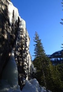
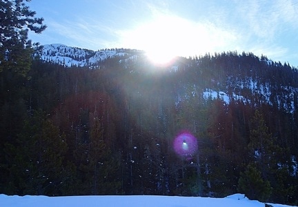
We knew we wanted to get up and around Mt. Baker, but weren't too sure if we wanted to fight the usual crowds of Artist Point. Instead we stopped at the Glacier Ranger Station to get a better idea of our options. Our first thought was to head towards Heliotrope Ridge, but learned that we would need a snowmobile to get there! The Salmon Ridge Snow Park would be nice, but more a valley forest walk, with few views of the mountains. So we opted for the challenging climb up the Excelsior Peak Trail. The trailhead was easy to get to, a well-labelled parking lot about 8 miles east of the Glacier Ranger Station. There were a few cars already there when we pulled in just before 10 a.m. It was cold and a bit breezy as we got going, strapping on our snowshoes and arranging our gear. Our fingers were pretty frozen by the time we hit the trail. 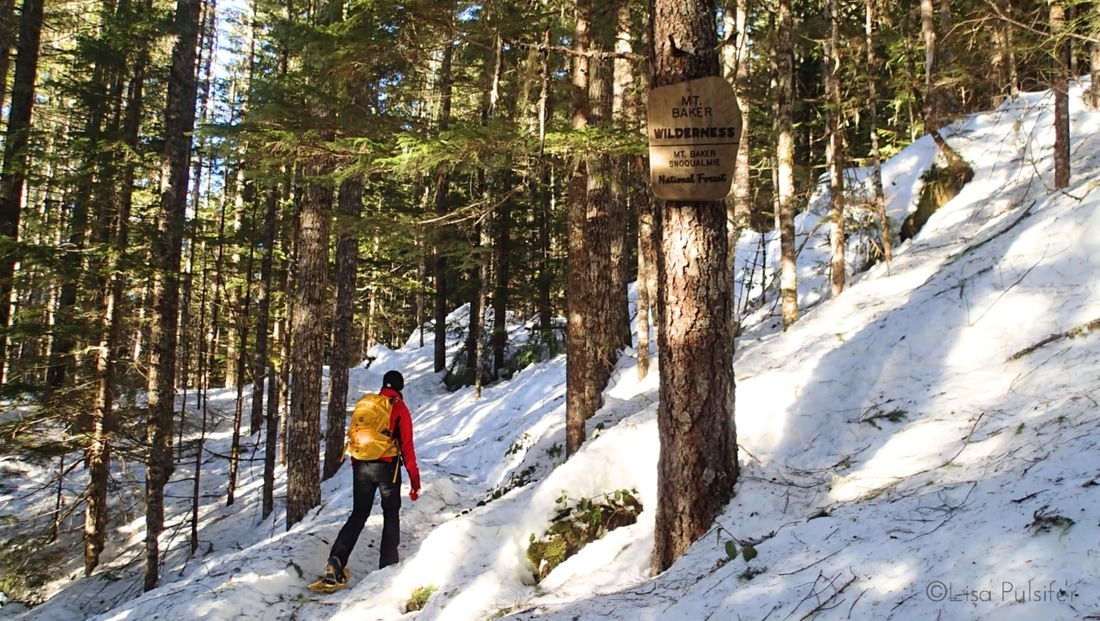 The trail climbed steadily through the forest, and we were grateful for the heel lifts on our snowshoes to take some of the pressure off our calves. It wasn't too long before our fingers were warming up, as was the forest around us, catching the morning sun. A few switchbacks later we took a brief rest stop to admire an incredible ice formation dangling off some mossy rocks. 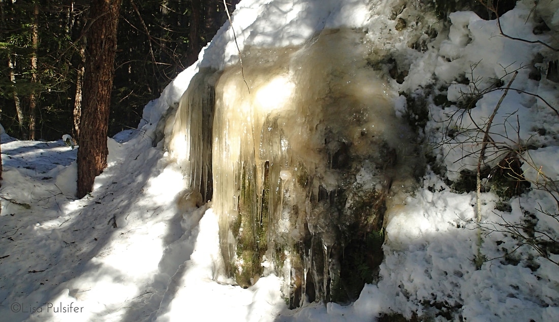 Cool ice formations on the rock We had been moving along so well that I was sure we were a couple miles along already. Unfortunately, I was to learn that there was still a lot of mountain to climb ahead of us! After a handful more switchbacks, and deepening snow, we popped out into a small meadow, which offered us our first view of Mount Baker to the south. 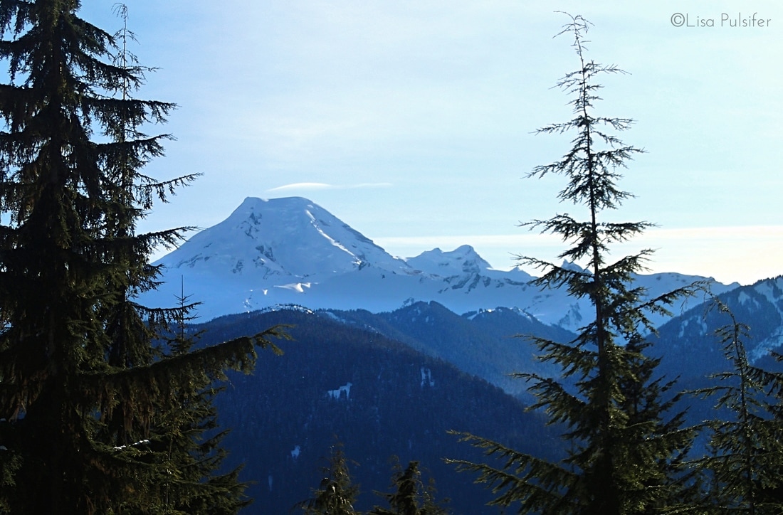 A sneak peak view of Mount Baker As much as I wanted to be near the top, I could see the mountain still towering above us. We still had another couple miles to go. The snow deepened and changed to a lighter, fluffier quality as we got higher. I was really glad we had our snowshoes, as we made the last challenging push through the trees and into the wide bowl below Excelsior Peak. We could see our destination, a ridge to the south of the peak. Unfortunately I've found that snow always makes slopes look shallower than they actually are! It was a slow, steep slog up to the ridge, but the reward was amazing views of Mount Baker and Mount Shuksan. 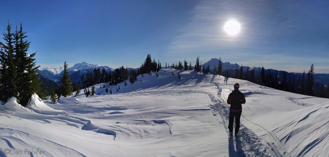 Taking in the awesome view 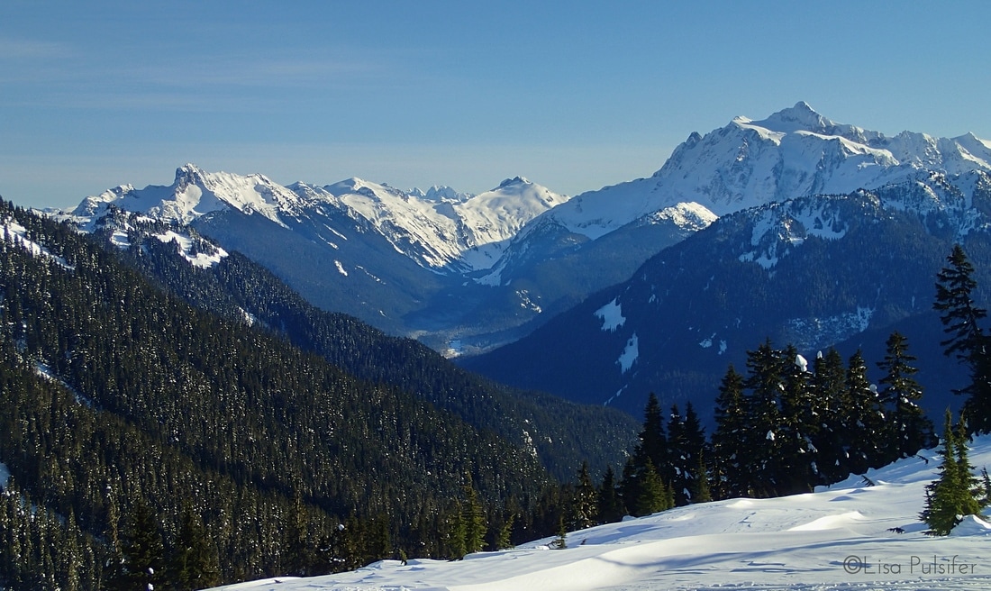 The Skagit Range and Mount Shuksan Another pair of snowshoers passed by and motored their way to the top of the peak. We didn't quite have the energy or chutzpah left to make it all the way to the summit. We were happy to settle in on the ridge and enjoy a hearty lunch of warm soup and home-baked bread while soaking in the sunshine and the view. 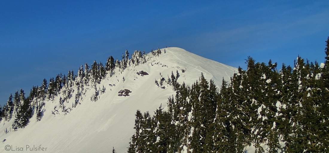 Hikers on Excelsior Peak Eventually we cooled off enough to want to get moving again. We moved quickly and confidently back down through the snowy bowl and back into the forest. What took us about 40 minutes to snowshoe up was barely 15 minutes on the way down!
The trip back through the forest passed quickly with good conversation. We were back to the car by 3 pm, just as the sun set over the nearest ridge. All in all we saw only 10 other hikers through the day, significantly less than the crowds at Artist Point! It was an awesome, challenging hike that proved to us just how strong and capable we are! I look forward to getting back to the Excelsior Peak trail in the summertime, and making it right to the peak! I've never been much of one for New Year's Resolutions but more for New Year's Reflections. These past couple weeks I've been doing a good bit of thinking about what 2016 offered me, and what I might be lucky enough to receive from 2017. This last year has been a particularly challenging one for me, as I was diagnosed with anxiety disorder and major depression. I could no longer function at my job as a teacher and had to go off on medical leave in order to develop a treatment plan. I'm glad to say that I'm starting to recover, thanks to the help of medication, therapy, yoga, hiking, knitting and the amazing support of my family and friends. Tonight I think I finally hit on what's been percolating in my brain for the past few months as I've been revisiting my various National Park experiences and absorbing my time on the John Muir Trail. I am starting to see how the Trail has been full of lessons for life and for my recovery. Ups and Downs The most obvious piece to me is the physical ups and downs of travelling along a trail as a metaphor for the mental and emotional ups and downs of life. I'm a mountain hiker and so most of my destinations are high up in the mountains. I see the time in the valleys as a lead-up to reaching the peaks and passes of the trail. But one needs to pass through those low valleys in order to then be able to climb to the next pass. The valleys also provide water and sometimes other awesome sources of nourishment (berries!), just as my low points in life have given me tools and resilience to be able to move upward again.  Visiting the high places means passing through some lows first. Breath Hiking in the Sierra Nevada mountains means getting high. No, not the drug-induced kind, but the elevation and altitude type! I had been learning about proper breathing in my yoga therapy course and was able to put that training to work on the trail. Our breathing is so important, and I can't believe how much I took it for granted until it was nearly stripped from me on our first climb to 12,000 feet! On the trail you're forced to breath properly, using a good strong diaphramagtic breath. I just have to remember that first climb to bring myself back to my breath.  Being present can mean noticing the little things Mindfulness Mindfulness is a term I've only recently become aware of. Essentially it means being fully present in the present moment, with acceptance and without judgement. I find that state is easiest to attain when hiking. There is only the trail immediately ahead of you to focus on, as well as your surrounding environment. There isn't much point expending energy on worrying about the trail further ahead until you actually get there. In day-to-day life, that means focusing on your immediate surrounding, and letting go of worries about the future or the past. Challenging, but worthwhile. 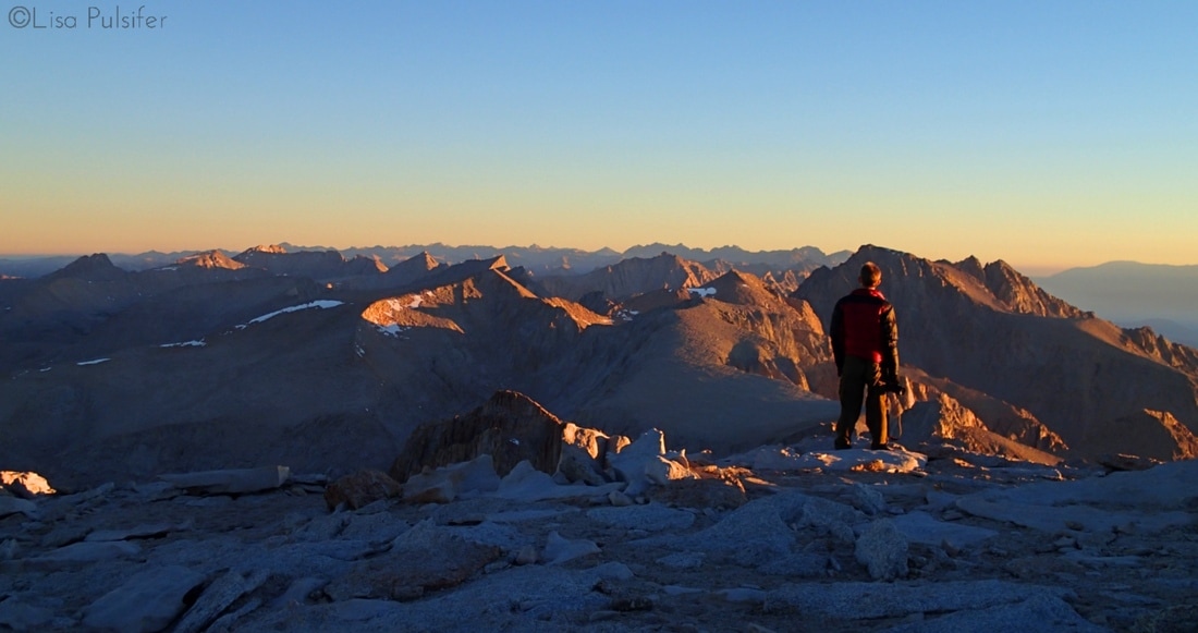 Is reaching a summit easy? Of course not, but worth every step! Effort Hiking isn't easy. Neither is our journey through life. When hiking on a trail one expects there to be challenging moments. You have to climb a hill to reach a viewpoint, or fight back pain if you develop blisters. One should expect (and perhaps even embrace!) the challenging moments in life. While easy moments are necessary, it is often the challenges we face that stick in our memories. 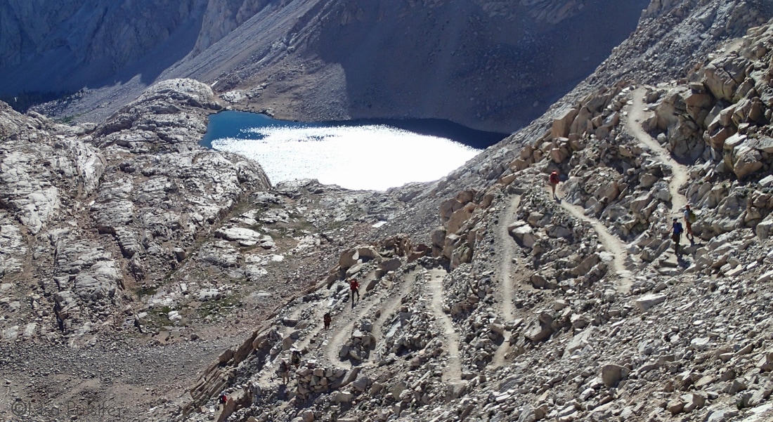 If life gives you a series of switchbacks, you only have 3 choices: stay in one place, go forward or go back. What's your choice? Resilience Among other elements, resilience is defined as the capacity to recover from difficulties, maintain a positive outlook and soldier on. Nowhere has that been more real for me than when hiking. I've had to endure worse weather conditions than expected, pain from blisters, and more miles on trail than originally planned. There aren't too many options when on trail. You can stop and feel miserable for yourself, or you can reset your attitude, continue to put one foot in front of another, and push through your challenges. 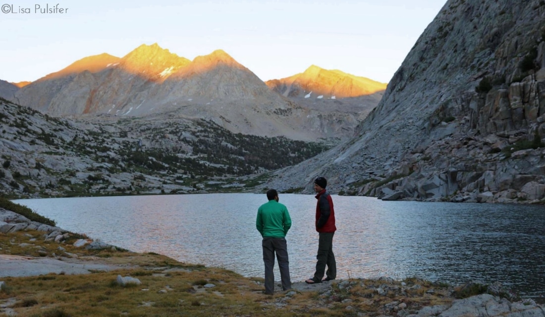 Sharing a sunset can be so much more meaningful Community The Trail brings people together in a way that reminds us all of our commonalities, instead of our differences. We meet many strangers along the trail, and inevitably swap hiking stories as well as life stories. Most people on trail are also very willing to help and support one another, especially in moments of challenge. But most importantly perhaps is the chance to share an experience with others, such as watching a sunrise or tackling a challenging climb. Those moments can be found in everyday life as well, so long as you keep an open mind and an open heart. Who'd have thought that the Trail had so much to offer?! I am extra grateful for these lessons, and the time for reflection and self-care that I was given in 2016, especially as I plan my next hiking adventures.
I hope that your 2017 is full of many miles on trail and especially full of meaningful moments and lessons that you can carry back into regular life with yourself. In honour of the U.S. National Park Service's 100th Anniversary, I've introduced a feature called "Find Your Park," named after the popular hashtag the NPS has been using this year to promote the parks. Each unique post features one of the U.S. National Parks that I have had the chance to visit.
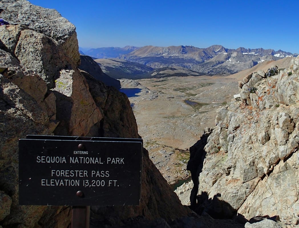
Sequoia National Park is a place of extremes. In the frontcountry zone of the park, you can find the Giant Sequoia Trees, considered the largest living things on Earth. In the backcountry, you find the tallest peak in the Lower 48 of the United States: Mount Whitney. And in between you can find high plateaus, roaring rivers, and unique sensitive species like the southen foxtail pine. This past summer, I entered into Sequoia National Park's backcountry along the John Muir Trail. We crossed into the park over Forester Pass, the highest pass of the John Muir Trail and the Pacific Crest Trail. Upon reaching the pass, we were treated to amazing views south of the Great Western Divide. 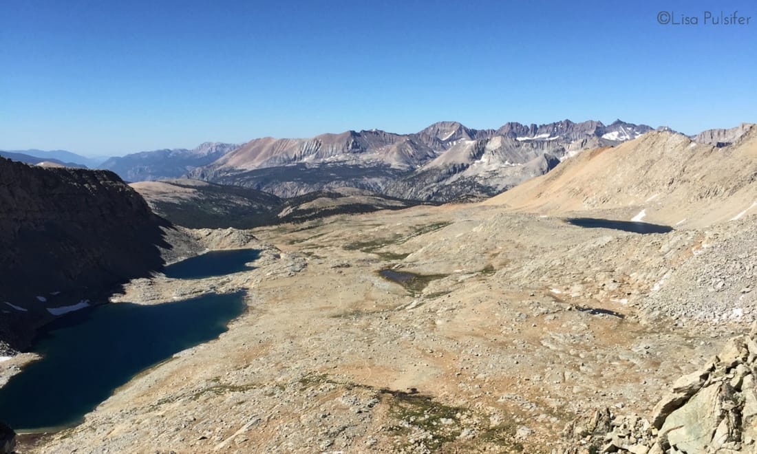 Looking back, I feel as though my time in Sequoia National Park's backcountry was rushed and that I didn't properly stop and take the time to appreciate the park. We only spent two nights in the park, one night near Wallace Creek at the junction for the High Sierra Trail, and then one night on the summit of Mount Whitney. Our hiking days were long as we traversed the high country. From Forester Pass, we dropped through the long hanging valley to Tyndall Creek, taking a much needed break from the hot sun. 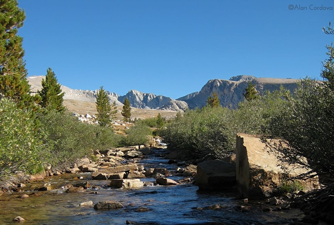 Tyndall Creek, looking towards Forester Pass. (Source: Alan Cordova on Flickr) As we continued southward, we climbed up onto and crossed over Bighorn Plateau. Unfortunately no bighorns were to be seen (and seldom are, considering the name) but we had amazing views west of the Great Western Divide. 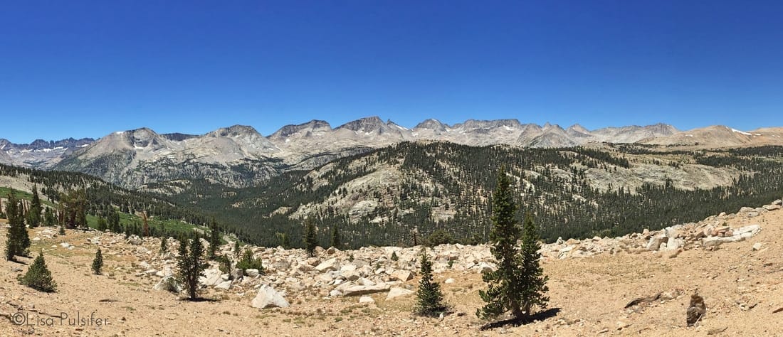 The Great Western Divide If I could have a do-over of this section of the John Muir Trail, I would build in a night spent on Bighorn Plateau. There is a large tarn (high alpine lake) on the plateau for water, and some small peaks to scramble up. More importantly, I can only imagine how crisp and clear the night sky would be from that location. As we rounded the southern edge of the Bighorn Plateau, we were given our first impressive view of Mount Whitney. 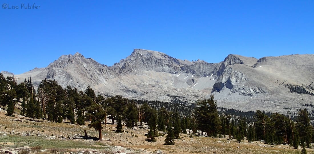 Mount Whitney as seen from Bighorn Plateau From the Bighorn Plateau we dropped down to a trail junction at Wallace Creek. The High Sierra Trail follows Wallace Creek west to the Kern River and then south down a canyon before turning west again to climb over the Great Western Divide. The one-way, 72 mile trail can be done in about 5 to 7 days. It is definitely on my to-do list! After a good night's rest at Wallace Creek, we continued south for a few miles before turning east towards Mount Whitney. We stopped for a relaxing break in Crabtree Meadows, a popular campground for hikers heading to the summit of Mount Whitney. 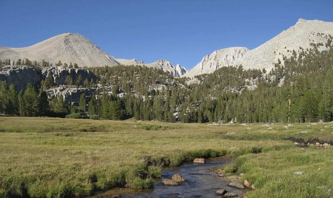 Crabtree Meadows with Mt Whitney behind (Source: Wikimedia Commons) The next couple miles were incredibly enjoyable as we made the slow climb out of the treeline to Guitar Lake. We constantly had Mount Whitney looming ahead of us, and the surrounding forest seemed so unique, with it's chapparal and sparse twisted old trees. 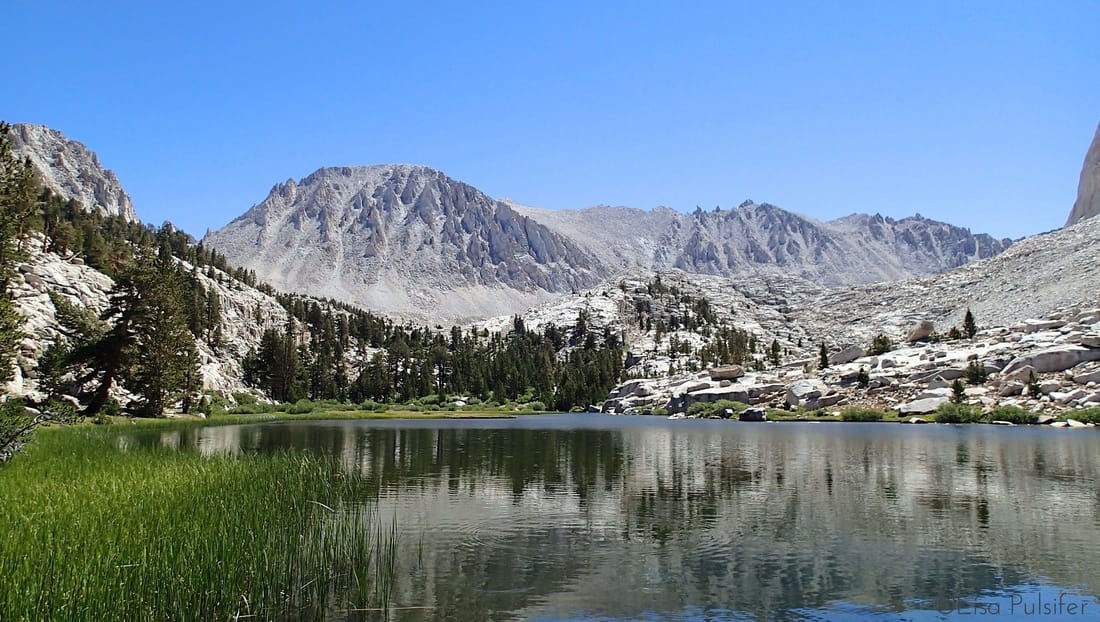 Treeline Lake, with Mt Whitney looming. We set up a temporary camp at Guitar Lake, sheltering from the high-altitude sunshine and resting before climbing 3,000 feet of elevation over 4.5 miles of trail. Our rest time was somewhat interrupted by an unfortunate Search & Rescue Operation. Read more about it on my previous blog post JMT: Search and Rescue. The climb to the summit of Mount Whitney was both physically and mentally challenging, but also incredibly rewarding. There is truly no better feeling than standing on top of a 14,500 foot peak, after weeks spent hiking towards it! 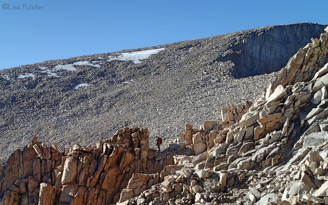 Working our way along Whitney Crest towards the summit We were lucky enough to have amazing weather and so were able to spend the night on the summit, enjoying both a sunset and a sunrise. To read more about our experience climbing the mountain, visit my previous posts JMT: Whitney Summit and JMT: Sunrise at 14,505. 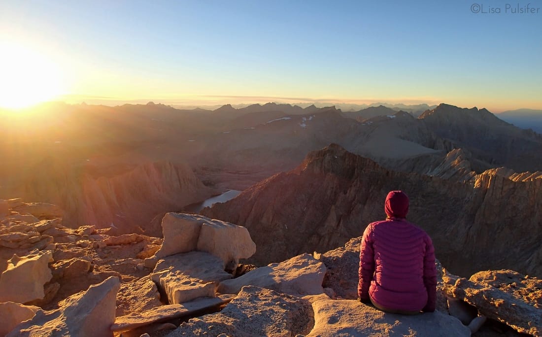 Conclusion
Many people visit Sequoia National Park exclusively to see the largest trees or to summit the highest peak. However the park is so much more than that, with miles and miles of trails to explore, passes and plateaus to stand on, and rivers to relax beside. If you can't take a week to hike a section of the John Muir Trail or the High Sierra Trail, then venture to the end of the road in Mineral King and pick a lake to visit overnight, or tackle the 27 mile Sawtooth Pass Loop. You won't be disappointed by what Sequoia National Park's backcountry has to offer. In honour of the U.S. National Park Service's 100th Anniversary, I've introduced a feature called "Find Your Park," named after the popular hashtag the NPS has been using this year to promote the parks. Each unique post features one of the U.S. National Parks that I have had the chance to visit.
My time in Sequoia National Park's front country was far too short. It was tied in with a visit to Kings Canyon National Park, and so I really only got a day to visit with the Giant Sequoias. It was certainly enough to give me a taste and to make me want to return and explore the many trails, trees and meadows much more extensively. We drove into Sequoia National Park from the northern entrance, which first passes through Kings Canyon National Park. Our goal for the afternoon was to visit the largest living tree on the planet: the General Sherman Tree. We pulled into Logdgepole Village and enjoyed a quick visit of the Visitor's Center. We then hopped onto a free shuttle bus to the General Sherman Tree. 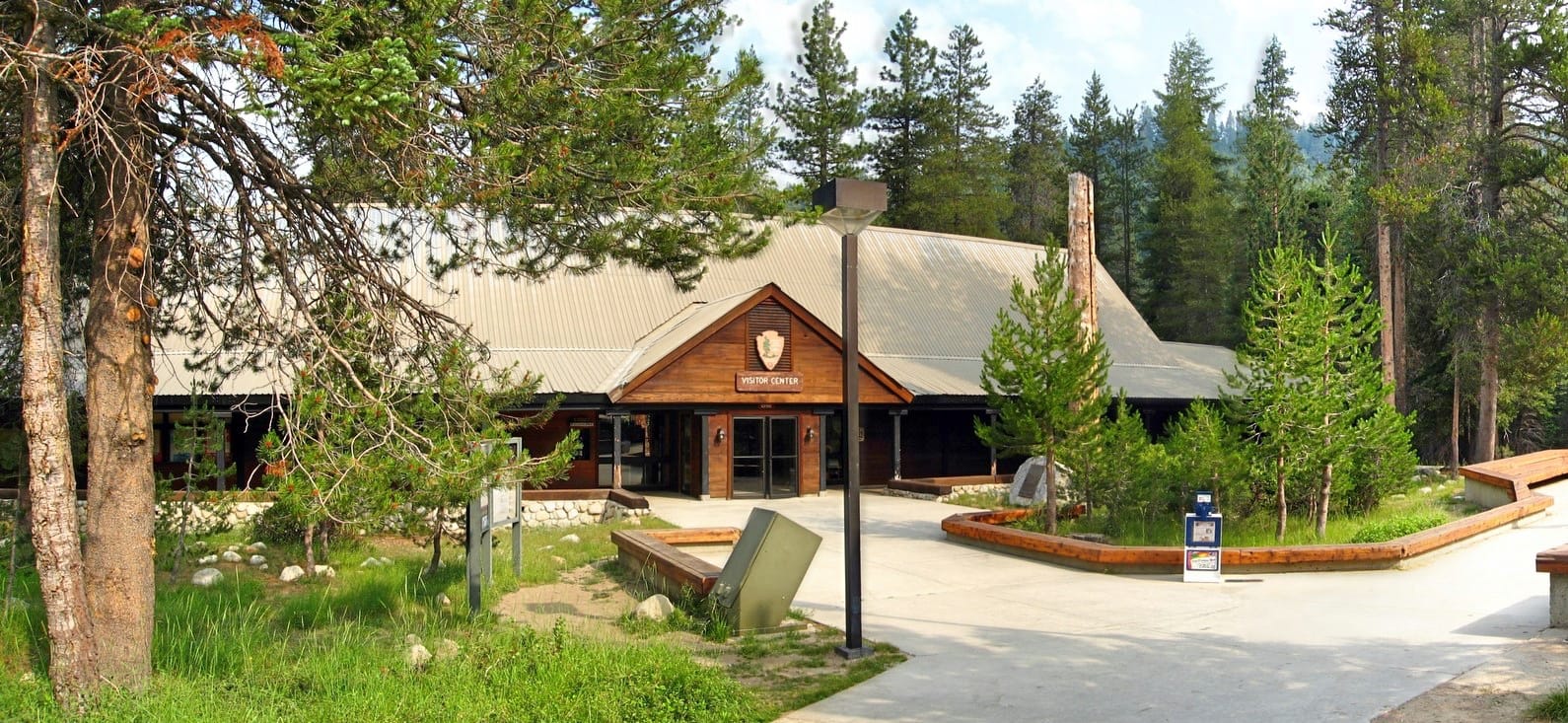 The Visitor Center in Lodgepole Village. The trip was about 15 minutes long and dropped us at a trailhead just north of the General Sherman Tree. It was only a few minute's walk along a paved pathway to the base of the giant tree. The tree is not the tallest in the world, but the largest by volume. It stands 275 feet high and has a bole volume of 52,513 cubic feet. The tree is a giant among giants, and so doesn't necessarily stand out from the forest around it. 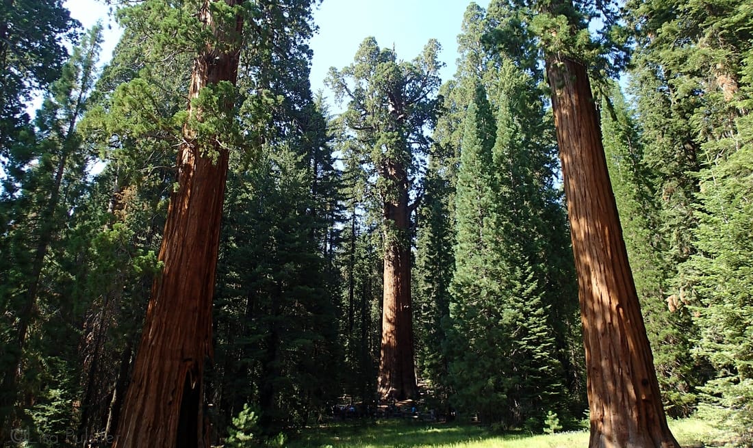 The General Sherman Tree, framed by other Giant Sequoias. It was a busy Satruday afternoon in August and there were lots of other visitors in the main grove. However, after a quick visit to General Sherman, we headed down a trail enjoying a surprisingly quiet and peaceful wander to the Sequoias. 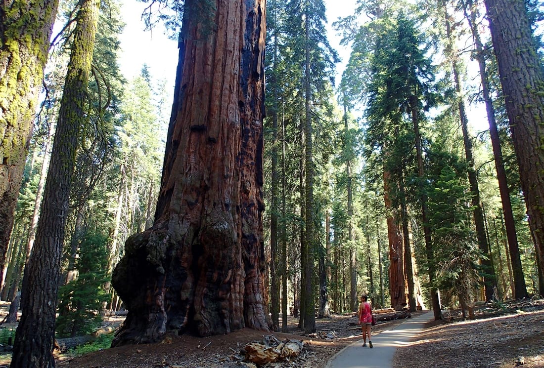 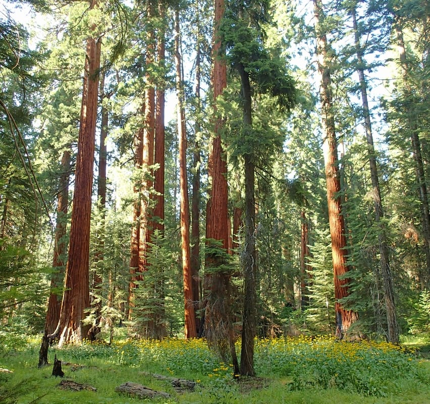 Some younger sequoias in the Giant Forest There are over 40 miles of trail in the Giant Forest area of the park. We chose a relatively direct path, hiking about 3 miles from General Sherman to the Giant Forest Museum. Along the way we got to see some awesome stands of sequoia, some Native American made mortar holes and pass by some lovely meadows. We enjoyed a quick visit at the Giant Forest Museum to learn more about the Giant Sequoias and the park that protects them, and then hopped back on the shuttle to get us back to our car. With another day or two, we would've returned to the Giant Forest, parking in the south end. From there you can climb the 400 steps to the top of Moro Rock for an amazing view, visit Tokopah Falls or wander around the edges of Round Meadow and enjoy the towering trees. 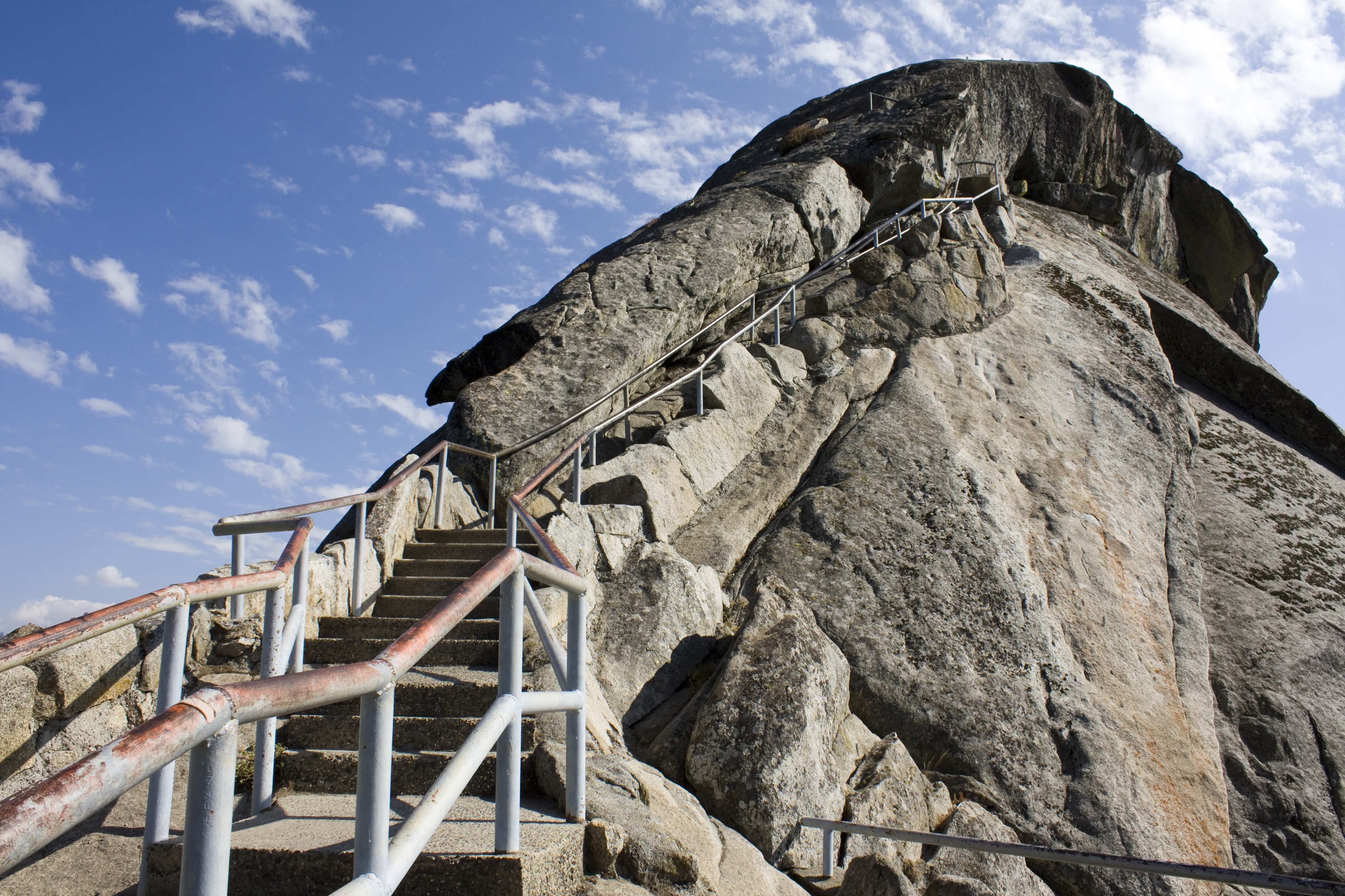 Climbing to the top of Moro Rock. (Source: Wikimedia Commons) 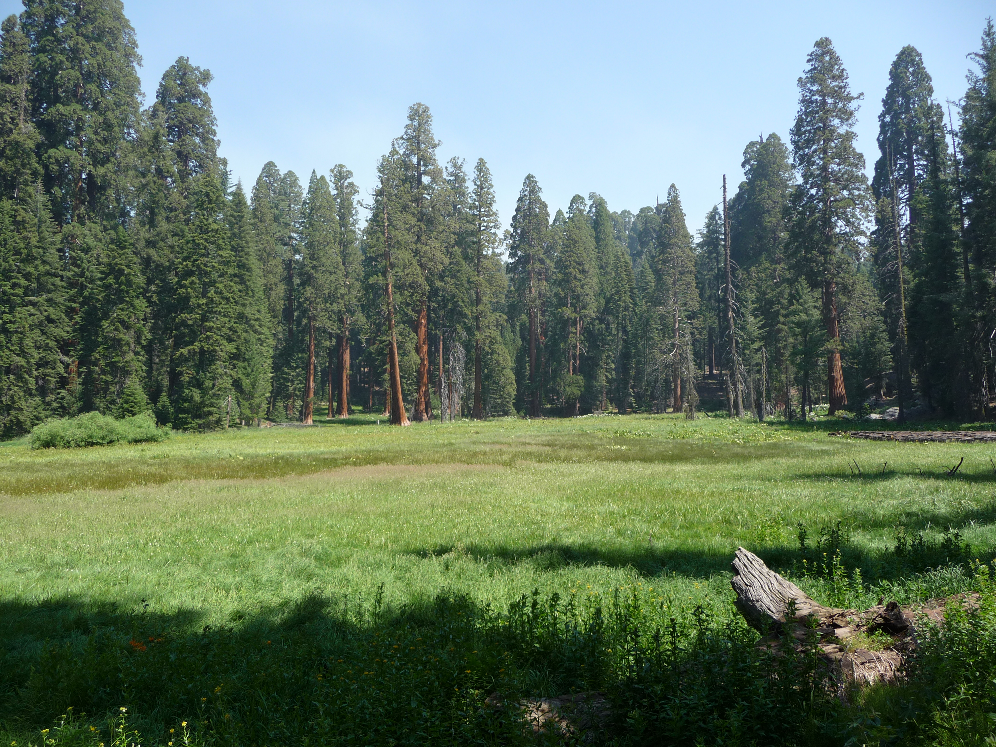 Round Meadow (Source: Wikimedia Commons) Another frontcountry area of the park to explore is Mineral King, a long glacial valley about 2 hours drive from the Giant Forest. It is considered a remote frontcountry area, and has no services so campers and hikers need to bring in all necessary gear. There are a number of alpine lakes to explore, including Monarch Lakes and Crystal Lake. 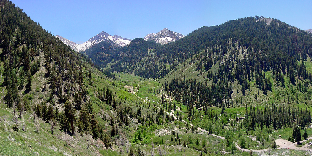 Mineral King Valley (Source: Stephen Hayden Photography, on Flickr) Conclusion
Sequoia National Park is a huge park, encompassing thousands of feet of vertical terrain to explore. The main frontcountry area is mostly between 5,000 and 9,000 feet, offering exploration of the montane forest, home to the Giant Sequoias. One day is enough to explore just the Giant Forest, but there are many more valleys, lakes and peaks to visit on day hikes if you can afford a few nights in a campground. |