The day after our aborted backpacking trip in the north-east corner of Mount Rainier National Park was grey and dreary, though a bit less rainy. After some discussion and perusal of our map, we decided to head to Glacier Basin, a trail that conveniently started about 50 feet from our campsite.
Hike Name: Glacier Basin
Date: Saturday September 3
Location: Mount Rainier Nat'l Park
Approx. drive time from home: 4 hours
Distance: 8.5 mi. / 13.5 km (return)
Elevation gain: 2900 ft / 880 m
Max. elevation: 7200 ft / 2200 m
Time on trail: 4 hours
Date: Saturday September 3
Location: Mount Rainier Nat'l Park
Approx. drive time from home: 4 hours
Distance: 8.5 mi. / 13.5 km (return)
Elevation gain: 2900 ft / 880 m
Max. elevation: 7200 ft / 2200 m
Time on trail: 4 hours
The trailhead is at the west end of the White River Campground, on Loop D. However, the parking lot is back down the road a few hundred feet.
The first mile or so of trail climb very gradually through a lush forest of cedars, pines, and firs. We got our first peek-a-boo view of Mount Rainier about a mile and a half in, when the trail moved closer to the shoreline of the Inter Fork of the White River.
The first mile or so of trail climb very gradually through a lush forest of cedars, pines, and firs. We got our first peek-a-boo view of Mount Rainier about a mile and a half in, when the trail moved closer to the shoreline of the Inter Fork of the White River.
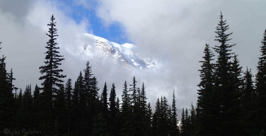
A peek-a-boo view of Mount Rainier from the trail.
The trail continued to meander west-ward. At mile 2.4, we reached the junction for the Burroughs Mountain Loop Trail. After this point we had some steeper switchbacks, hiking another 0.7 miles to reach Glacier Basin Campground.
The campground is a beautiful spot right at the edge of a lovely alpine meadow. We took a short break and then ventured onwards, onto the unmaintained section of trail used by mountaineers. Our goal was to get right up to the toe of the Inter Glacier which is tucked between Mount Ruth and The Wedge.
We quickly left the tree line as we climbed along a moraine above the river. It was easy to see the path that the Inter Glacier had taken down the valley. As we got further into the basin the trail veered southward, becoming a bit less defined and a bit more rocky as we approached the glacier.
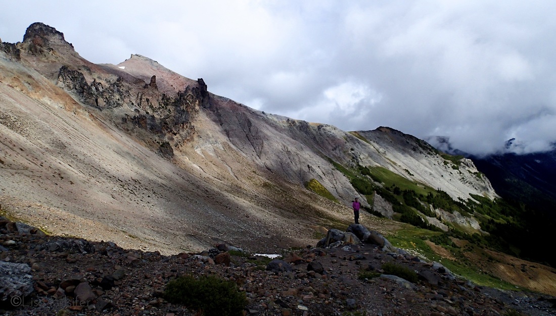
Near the snowline in Glacier Basin
We made it to the toe of the glacier right around noon, about 2 hours after hitting the trail. We parked ourselves on a boulder and watched as a group of mountaineers got geared up and roped up to head up the glacier to Camp Shurman. We had decent views of the peaks around the basin, though Rainier itself was shrouded in lowering clouds.
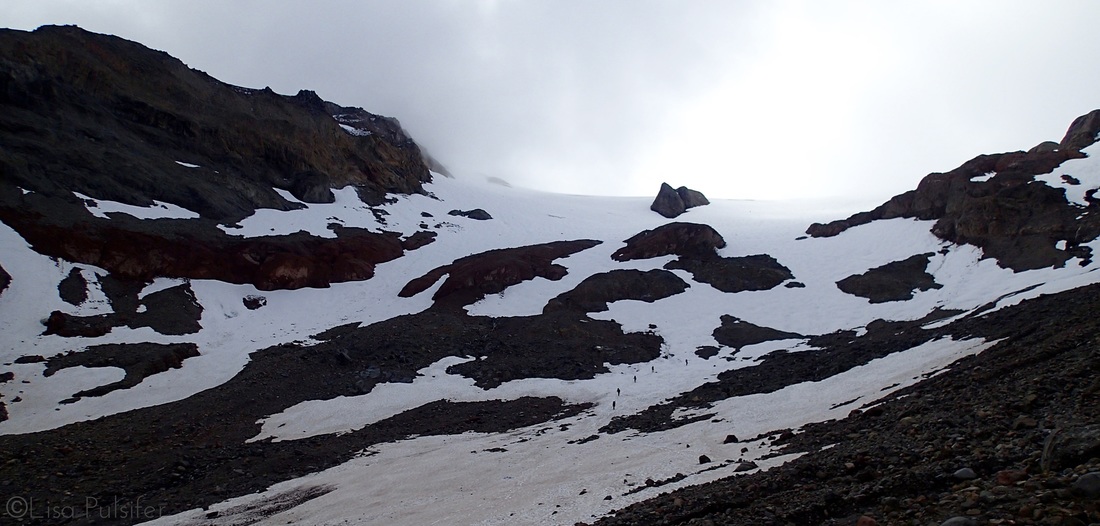
A tiny train of mountaineers climbing onto the Inter Glacier
We also happened to spy a white blob moving about in one of the meadows across the basin. We decided to explore the basin and get closer to what we hoped was a mountain goat. We were right, though unfortunately we startled him sufficiently that he bounded off down a ravine.
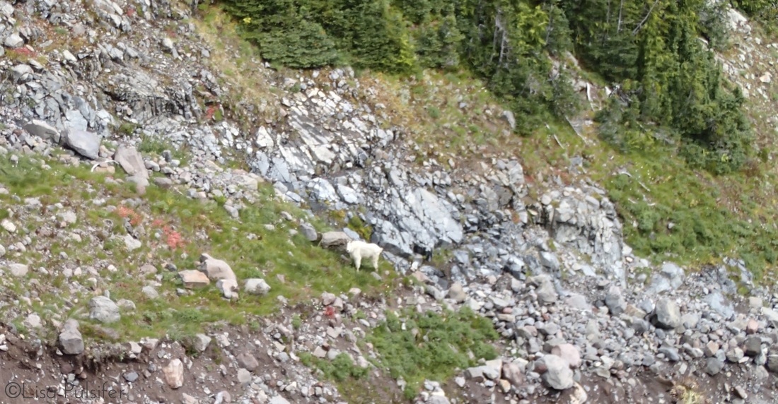
A mountain goat!
On the trip back we took the half-mile spur trail onto the Emmons Moraine which offered up great views of the Emmons Glacier, the largest glacier on Mount Rainier. It was particularly interesting to see how the soil of the moraine and the nearby glacier created a micro-climate for unique species like the Whitebark Pine.
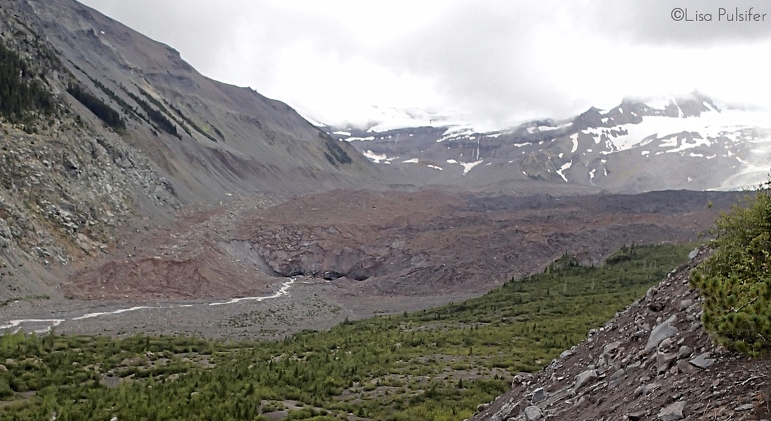
The toe of the Emmons Glacier
We made it back to camp by mid-afternoon, getting in just before the rain rolled in.
All in all, Glacier Basin is a great day hike for those of varying abilities, and more importantly for the drearier, wetter days around Mount Rainier. The newer trail is wide and well graded. This trail offers the chance to see a number of different climate zones found in Mount Rainier National Park without exerting too much effort.
All in all, Glacier Basin is a great day hike for those of varying abilities, and more importantly for the drearier, wetter days around Mount Rainier. The newer trail is wide and well graded. This trail offers the chance to see a number of different climate zones found in Mount Rainier National Park without exerting too much effort.
